

Caoinkeen [An Caincin]
Good walks are even better shared.
Overview
Caoinkeen [An Caincin]
Caoinkeen stands proudly at 518 meters, nestled within the mesmerizing Sliabh Mish Mountains. With its unique terrain and rich geological features, this mountain offers both a challenge and a feast for the eyes.
Geology
The mountain is primarily composed of sandstone and slate, a reminder of the Earth’s astonishing history during the Carboniferous period. It offers a rocky environment mixed with lush, grassy patches. The combined textures create a hiking experience that will entice any outdoor enthusiast.
Access
Once you’ve got your gear sorted, head over to the Aghadoe car park, where you can throw your car keys onto the back seat (too risky to leave them in sight!). The route begins here, and it’s a loop of about 7.5 km, taking roughly 3.5 hours to complete. The terrain is classified as moderate, so be ready for a bit of a workout!
Public Transport
If you’re relying on public transport, catch a bus to the charming village of Camp. From there, a pleasant walk of about 4 km will bring you to the start of your adventure.
Summary
Caoinkeen enjoys its status among the peaks and proudly supports its friendly cairn and trig point summit features. Be savvy with your footwear, as those boggy patches can turn a pleasant stroll into a comedy of errors if you aren’t careful.
Views
The views from the top are nothing short of delightful. On a clear day, you’ll be treated to a stunning panorama of the Shannon estuary, Kerry Head, and if you squint just right, perhaps, the Dingle Peninsula too! Best viewed in spring or early autumn, the scenery is a rainbow of colours that can fill an artist's palette in an instant.
Hazards
But hold your horses! With great views come great responsibility. The trails can be slippery, especially after a good rain, and the weather can change quicker than you can say, 'What’s that cloud?' Always check your weather app before setting off.
In conclusion, if you're looking for a hike that strikes a balance between charm and a bit of challenge, Caoinkeen should definitely be on your list! So lace up those hiking boots and may your journey be filled with joy (and snacks!).
Last Updated
This information has been assessed and confirmed to be accurate as of 2023-10-01.
Source
Data sourced from Ordnance Survey.
Explore routes near Caoinkeen [An Caincin]
Public walks starting within 80 km of this hill. Nearby does not mean a route reaches the summit; check its map and access before setting out.
No public routes are currently listed within 80 km of Caoinkeen [An Caincin] on Walkmates. This does not mean there are no paths here. Explore the map and check local access information before planning a walk.
Route planning notes
These notes describe possible approaches, not verified navigable routes or permission to cross land. Check current paths, local access rules and conditions before setting out.
Caoinkeen Loop from Aghadoe
A scenic loop that starts from Aghadoe, providing access to stunning vistas of the surrounding landscape.
Make a day of it, together
Find someone to share the walk with, or organise a day out along a route you like.
Photo Gallery
View all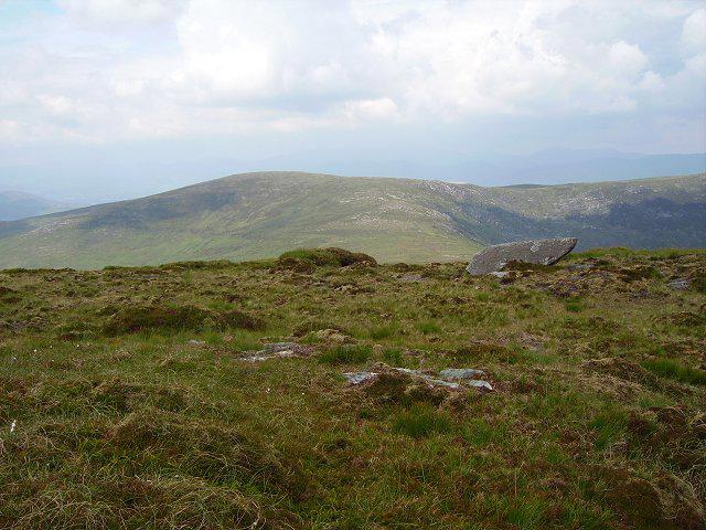 Photo could not load
W0164 : Caoinkeen summit
Richard Webb
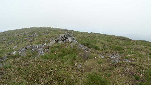 Photo could not load
W0164 : Summit cairn on Caoinkeen
Colin Park
Hill facts and local notes
Classifications
Elevation
693m
2,273 ft
Prominence
107m
Coordinates
51.8250, -9.4360
W010645
OS Map
85
At the Summit
The summit features a modest cairn and a trig point, often adorned with a friendly selection of summit registers where tired hikers can leave their mark (not literally, please!).
Terrain & Geology
Caoinkeen is predominantly composed of sandstone with elements of slate, which adds to the rugged beauty of the terrain. These rock formations were formed during the Carboniferous period, contributing to the fascinating geological history of the region.
Views & Scenery
From the summit, you can enjoy panoramic views of the Shannon estuary, Kerry Head, and on clear days, the intriguing peaks of the Dingle Peninsula.
History & Heritage
Name Origin
The name 'Caoinkeen' translates loosely to 'the small waste or strayed place,' potentially alluding to the rugged terrain that could easily lead you astray – just ask those who have wandered off the beaten path!
Historical Significance
Caoinkeen is part of the rich tapestry of Irish heritage, connecting locals to their past and inspiring hikers with its majestic presence.
Getting There & Facilities
Check current local access restrictions, parking rules and transport timetables before travelling. These notes do not confirm public access to the summit.
Parking
You can find parking at the Aghadoe car park, where a few spaces are available. Arrive early to grab a spot, as this is a popular trailhead.
Public Transport
The nearest bus stop is in the village of Camp, which is approximately 4 km from the trailhead. Local buses run several times a day, but check the schedule to avoid a long wait.
Nearby Facilities
There are limited facilities nearby, so make sure to pack enough snacks and water. The nearest café is in Tralee, offering great post-hike treats.
Safety Information
Known Hazards
- Wet and muddy trails can be treacherous, especially during the winter. Be wary of sudden changes in weather, as visibility can drop in a jiffy.
General Safety Tips
- Check weather conditions before setting out
- Carry appropriate clothing and equipment
- Let someone know your planned route
- Take a map, compass, and GPS device
- Carry emergency supplies: food, water, first aid kit, torch
Hills
Some common questions about the hills answered
Are there group walks up Caoinkeen [An Caincin]?
Many walkers use Walkmates to join or organise walks with others. You can check for group walks around Caoinkeen [An Caincin] through the maps
Are there other walkers around Caoinkeen [An Caincin]?
Activity varies by location and time, but Walkmates lets you see whether others have shared walks or shown interest in this area. Find other people through the walking friends search walking friends for Caoinkeen [An Caincin] search or of course create your own walk for Caoinkeen [An Caincin]
Can I organise a walk to Caoinkeen [An Caincin]?
Yes. If there aren’t any walks listed already, you can create a walk and make it available for others to join.
If you're signed up to Walkmates, you can create a walk to Caoinkeen [An Caincin].
How do I find a walk up this hill?
There are often multiple ways to walk this hill, depending on experience and route preference. Walkmates helps you explore walks and routes that others have shared.
Can I suggest a new route up Caoinkeen [An Caincin]?
Yes. You can suggest or create routes to share with others. Walkmates focuses on the social side of walking, so routes are used to help people organise walks and explore areas together, rather than as detailed navigation tools or route libraries.
Other uses really appreciate knowledgeable walkers sharing their routes. Share your favourite route to Caoinkeen [An Caincin] here
The is an error or something incorrect about this hill. How do I let you know?
We always strive to keep the information on Walkmates as accurate as possible. If you find an error, please let us know through the contact form and we'll aim to correct it as quickly as possible
Community Discussion
Comments
Location
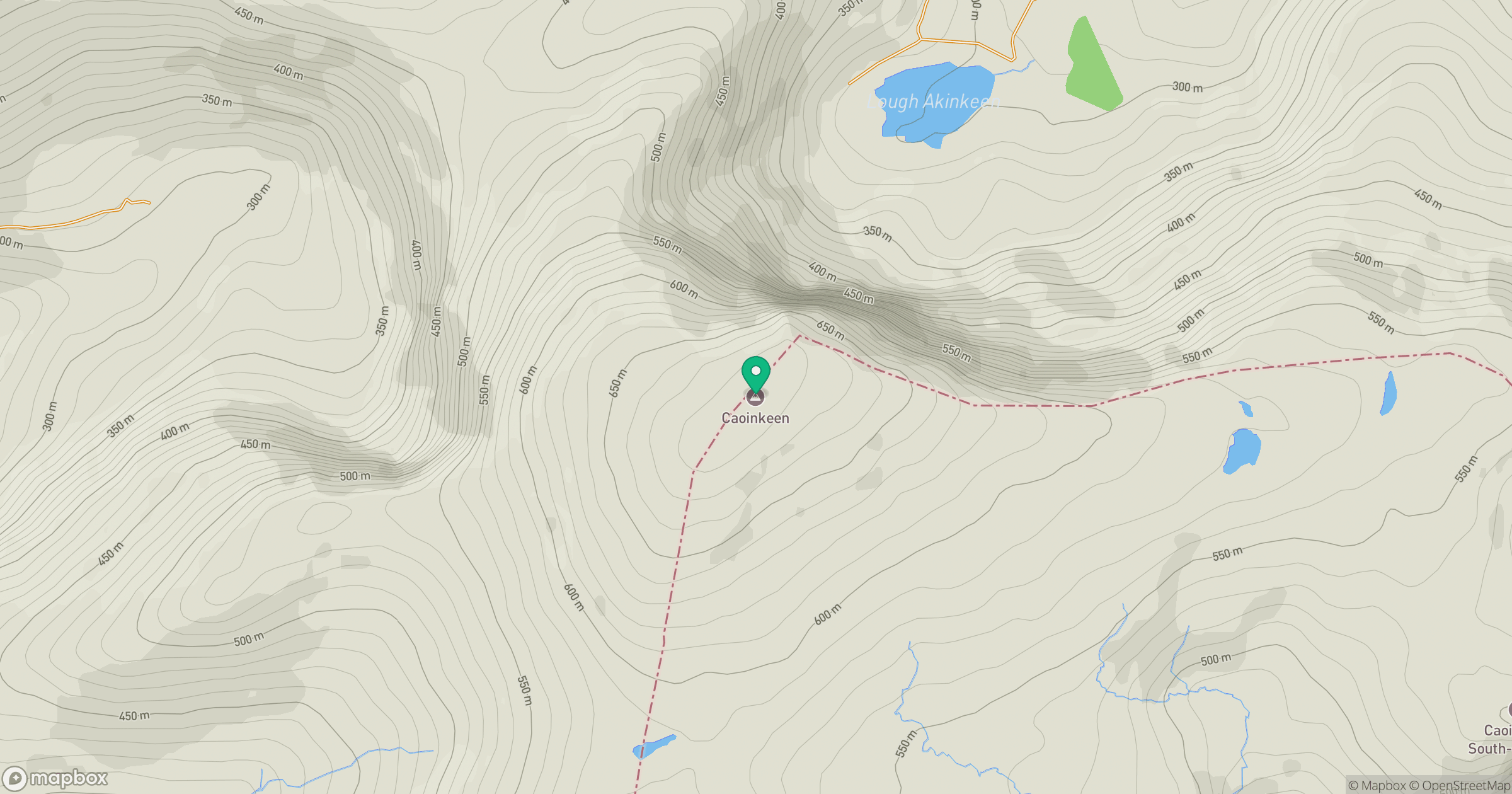
Grid reference: W010645
View on OpenStreetMapOpens a map in a new tab, centred on the hill.
Hills within 30 km
Straight-line distance, not a walking route or confirmation of access.
Torc Mountain
535m
Carrauntoohil
1,039m
Knockboy [An Cnoc Bui]
705m
Carran [An Carn]
604m
Conigar [An Coinigear]
572m
No comments yet. Be the first.